Cr-3 Circular Computer
Price
€49.00


There are 35 products.
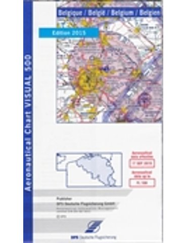
Belgium 1:500 000 topographical chart produced by the German Aviation Authority. It details airspace up to FL 100 and shows VFR Flight Information, Civil and Military Airfields, Restricted Airspace and Radio Navigation Information, including VOR, DME, VOR/DME, TACAN and VORTACs.
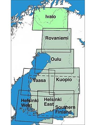
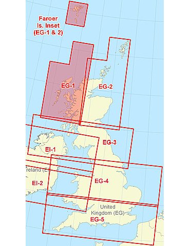
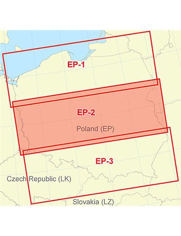
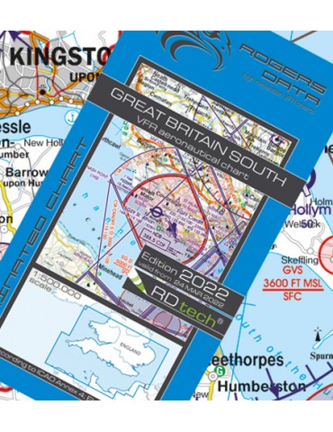
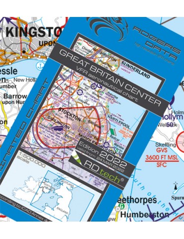
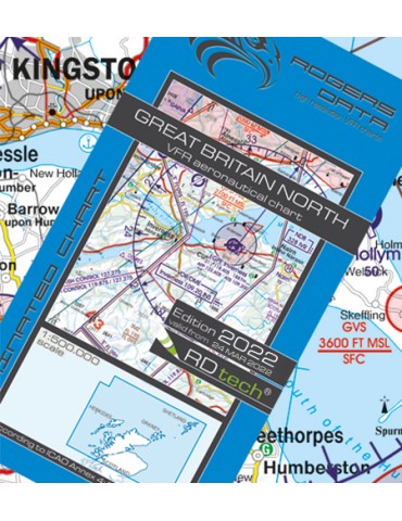
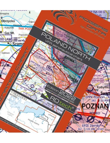
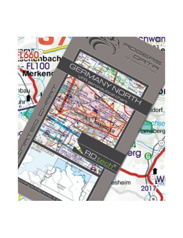
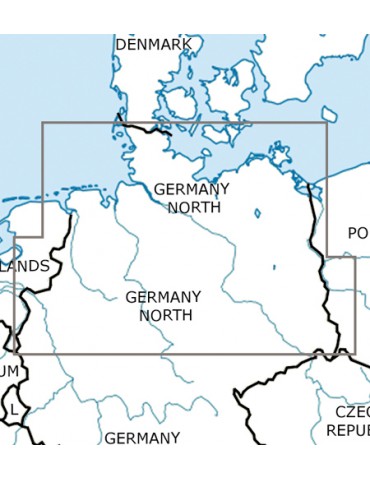
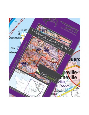
Aeronautical VFR chart scale 1:500.000 Clear presentation of the ATS airspace structure. VFR sectors on international airports. Reporting points, restricted and danger areas, border crossing points aerial sporting, areas with sensitive fauna.
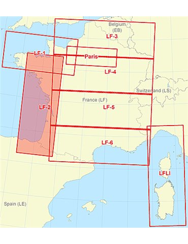
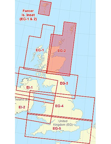
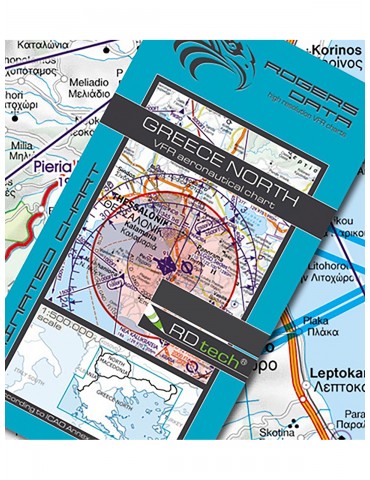
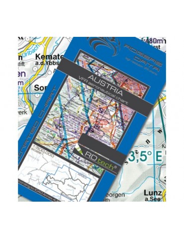
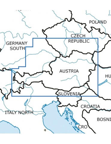
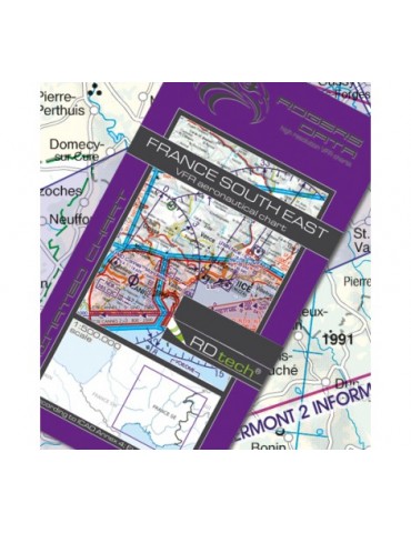
Aeronautical VFR chart scale 1:500.000 Clear presentation of the ATS airspace structure. VFR sectors on international airports. Reporting points, restricted and danger areas, border crossing points aerial sporting, areas with sensitive fauna.
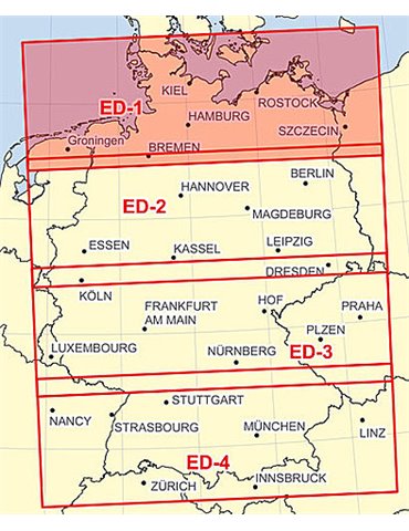
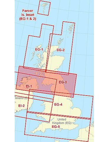
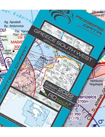
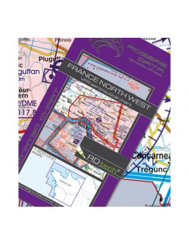
Aeronautical VFR chart scale 1:500.000 Clear presentation of the ATS airspace structure. VFR sectors on international airports. Reporting points, restricted and danger areas, border crossing points aerial sporting, areas with sensitive fauna.
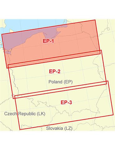
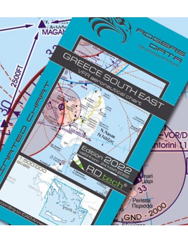
Aeronautical VFR chart scale 1:500.000 Clear presentation of the ATS airspace structure. VFR sectors on international airports. Reporting points, restricted and danger areas, border crossing points aerial sporting, areas with sensitive fauna.
Aeronautical VFR chart scale 1:500.000 Clear presentation of the ATS airspace structure. VFR sectors on international airports. Reporting points, restricted and danger areas, border crossing points aerial sporting, areas with sensitive fauna.
Aeronautical VFR chart scale 1:500.000 Clear presentation of the ATS airspace structure. VFR sectors on international airports. Reporting points, restricted and danger areas, border crossing points aerial sporting, areas with sensitive fauna.
Aeronautical VFR chart scale 1:500.000 Clear presentation of the ATS airspace structure. VFR sectors on international airports. Reporting points, restricted and danger areas, border crossing points aerial sporting, areas with sensitive fauna.
Aeronautical VFR chart scale 1:500.000 Clear presentation of the ATS airspace structure. VFR sectors on international airports. Reporting points, restricted and danger areas, border crossing points aerial sporting, areas with sensitive fauna.
Aeronautical VFR chart scale 1:500.000 Clear presentation of the ATS airspace structure. VFR sectors on international airports. Reporting points, restricted and danger areas, border crossing points aerial sporting, areas with sensitive fauna.
Aeronautical VFR chart scale 1:500.000 Clear presentation of the ATS airspace structure. VFR sectors on international airports. Reporting points, restricted and danger areas, border crossing points aerial sporting, areas with sensitive fauna.
Aeronautical VFR chart scale 1:500.000 Clear presentation of the ATS airspace structure. VFR sectors on international airports. Reporting points, restricted and danger areas, border crossing points aerial sporting, areas with sensitive fauna.
Aeronautical VFR chart scale 1:500.000 Clear presentation of the ATS airspace structure. VFR sectors on international airports. Reporting points, restricted and danger areas, border crossing points aerial sporting, areas with sensitive fauna.
Aeronautical VFR chart scale 1:500.000 Clear presentation of the ATS airspace structure. VFR sectors on international airports. Reporting points, restricted and danger areas, border crossing points aerial sporting, areas with sensitive fauna.